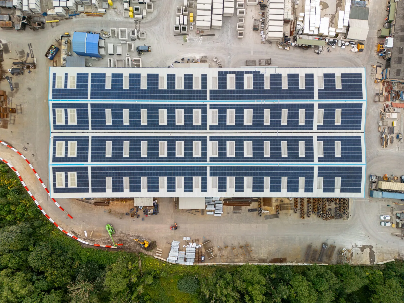
A property manager standing in a warehouse lot looks up at a roof that covers more ground than the parking lot, and asks how anyone checks all of it. On foot, the right answer is slowly, and not always safely. A drone can give the crew a broad first look before anyone steps onto the roof. In South Bend, IN, large low-slope and metal roofs call for different inspection approaches, and aerial images can help identify areas for closer hands-on checks.
Why we fly it first
Some roofs are hard to walk well. They are very large, steeply pitched, covered in fragile skylights or old metal panels, wet from a recent storm or partly under snow. Walking them takes time and carries risk, and a person on foot sees only the few feet in front of them. A drone can provide a broad view while keeping people off surfaces that may not safely carry foot traffic. Images give the owner a useful record of ponding, displaced flashing and other visible conditions. The drone does not replace hands-on work; it helps identify where a closer inspection should go.
The flight, step by step
Before the drone leaves the ground, we confirm the airspace, since sites near an airport may need authorization, and we agree the schedule with the property manager. Tenants receive a short tenant notice, because a drone overhead raises questions. We plan overlapping passes across the roof, usually in a grid, so the images can be stitched into one map. Then we fly slower, closer passes along parapets, edges, curbs and penetrations, where most failures begin. Each image is tagged with its location. When a thermal camera is part of the scope, we time that pass for the hours when the roof is releasing stored heat, because that is when wet insulation shows most clearly. Flights follow the rules for commercial drone operation, and we stop if wind, rain or low light make them unsafe.
What the images show
High-resolution images reveal a lot. They show standing water and the stained outlines left where ponds have dried, blistered or wrinkled membrane, open laps, displaced flashing, loose coping and edge metal, debris collecting in valleys, rust streaks on metal panels, and damage around rooftop equipment. A scaled map lets us measure how large a defect is and where it sits relative to drains and curbs. What a drone cannot do is touch, press or probe, and it cannot reliably tell dry insulation from wet by sight alone. That is where an infrared and core-cut moisture survey comes in, and where a crew on the roof confirms each finding with a probe.
After the storm
Speed matters most after severe weather. This part of Indiana has seen hail up to 1.25 inches near Crumstown on June 1, 2019, an F3 tornado in October 2001, and straight-line wind damage in October 2016. After events like these, a drone flight can document visible conditions when roof access is safe and help prioritize a later hands-on inspection. The images and the map document the condition for the insurer, which makes a claim easier to support, and a roof that needs work afterward moves straight into storm damage roof repair. If a claim is in play, our roof insurance claim assistance uses the same dated records.
Where it earns its time here
The roofs that benefit most are the large ones. The South Bend Airport Business Park lists 12 industrial spaces, the Indiana Enterprise Center in New Carlisle lists spaces of up to 992,620 square feet, and Mishawaka is home to the AM General manufacturing operation; the broader industrial area includes other employers and buildings. East in Elkhart, large-format manufacturing and assembly plants dominate the building stock. For a roof that is difficult to cover on foot, aerial images can help direct the inspection toward visible trouble spots. Roofs on and around South Bend International Airport often add the extra step of airspace planning, which we build into the schedule. For owners with distribution center roofs, a yearly flight makes year-to-year comparison simple.
Then someone still walks it
The flight ends with a set of images, a map and a list of areas to check. Then a person goes to those areas with a moisture meter, a probe and a camera, confirms each finding and records what the images could not show. The results combine into one report, with a photo log tied to the map. That is the same method we use in a full commercial roof inspection, with the drone added to cover ground a person cannot cover as well.
The deliverable is not a roof-condition verdict from the air. We mark images by roof zone, point out visible concerns, then check suspect seams, curb corners, and drain bowls on foot. If equipment blocks the view or a surface change needs testing, the photo log says so and the follow-up visit answers the question before the owner budgets a repair.
Commercial Roofing Questions
Can a drone inspection replace a walk on the roof?
Not by itself. A drone is excellent for coverage, safety and a quick first look, but it cannot probe a soft spot, test a seam or take a core sample. We use it to find the problems and to narrow where the crew walks. For a roof in poor condition, or one that is going to be the subject of a repair scope, the walk follows the flight. For a roof that is simply being monitored, a flight alone can be enough between full visits.
Do you need permission to fly near the airport or over my property?
We handle the airspace check before flying. Buildings near South Bend International Airport can fall inside controlled airspace and may need authorization, which we arrange before the flight. On your side, we need the property manager's approval and the access details for the site. We also tell the tenants and any security staff in advance so no one is alarmed by a drone over the building.
Does the drone work in snow, rain or high wind?
Not well, and we do not fly in those conditions. Rain, strong gusts and low light reduce image quality and safety. Snow cover hides the roof surface, so there is little to see. Winter flights are possible on dry days with clear surfaces. For hail or wind damage, we aim for the first safe window after the weather passes. If a flight is not possible, we say so and recommend the best alternative.
Will the flight disturb tenants or operations?
It should not. The flight takes place over the roof, so the drone is rarely noticed from inside, and it is much shorter than a full walk. We coordinate times with the property manager, avoid shift changes and quiet hours at sensitive tenants such as clinics, and send a tenant notice so staff know what to expect. If a building has outdoor activity or events, we plan the flight around them.
What do I receive after the flight?
You receive a labeled image set, a stitched map of the roof where the scope calls for one, and a photo log of the confirmed findings with locations. Where thermal imaging was included, we add those images beside the standard ones. We agree on the file format and delivery schedule with the owner before the flight. If you want a repair scope, we can write it from the same records.
Related Roof Work
- Infrared Roof Moisture Surveys
- Storm Damage Roof Repair
- Roof Insurance Claim Assistance
- South Bend and Mishawaka Industrial Area
- South Bend Airport Industrial Park
- Distribution Center Roofing
- Commercial Roof Inspection
Talk to Our Team
Tell us where the water is landing, what the roof is made of and when the building is easiest to reach.
Phone: 555-555-5555
Email: [email protected]